- City:
- Yosemite National Park, CA
- Site Type:
- Infrastructure and Utilities, Roads, Bridges, and Tunnels
- New Deal Agencies:
- Bureau of Public Roads (BPR), Conservation and Public Lands, Public Works Funding, National Park Service (NPS), Public Works Administration (PWA)
- Started:
- 1933
- Completed:
- 1934
- Contractors:
- C. G. Willis & Sons, Hayward Building Supply, Morrison-Knudsen, Peninsula Paving Company
- Quality of Information:
- Very Good
- Marked:
- No
- Site Survival:
- Extant
Description
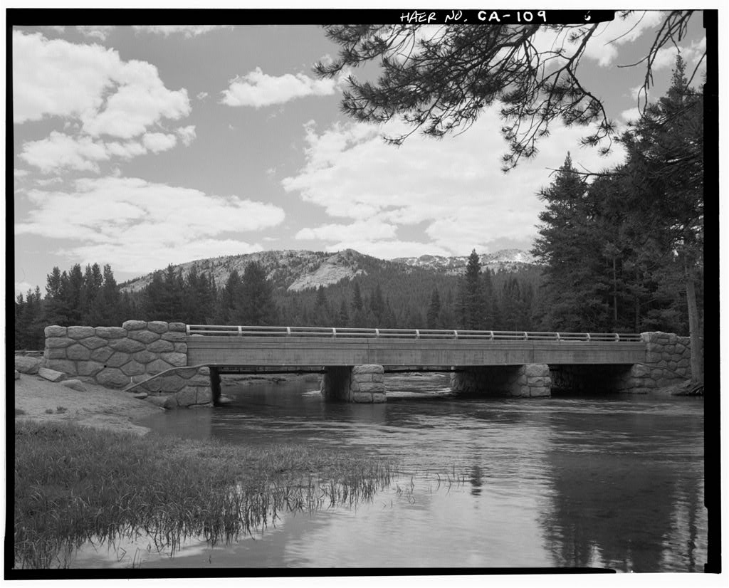
New Deal agencies realigned and reconstructed the Old Tioga road from 1933 to 1943, from Crane Flat to Tuolumne Meadows. An important element of the road project was the bridge over the Tuolumne River, just east of the Tuolumne Meadows campground. The bridge was constructed in 1933-34.
Funding came from the Public Works Administration (PWA); the Bureau of Public Roads (BPR) managed construction, using private companies; and the National Park Service (NPS) oversaw all work in the park.
The Tuolumne River bridge is a modern design of steel beams and concrete, but is dressed up with stone siding to accord with the National Park Service’s preferred ‘Rustic’ style.
The 45-mile long Tioga Road is the highest mountain highway in California. The original road was constructed in the early 1880s in order to access mining areas. Within a few years, the mines played out and the road was abandoned and subject to washouts. In 1890, Yosemite National Park was created and some improvements were made to the deteriorated road. In 1925, the National Park Service and Bureau of Public Roads (U.S. Department of Agriculture) signed a Memorandum of Agreement to construct new roads within the park. Planning, surveying and some construction took place in the late 1920s and early 1930s, but most of the work was done during the New Deal years.
The full reconstruction of the Tioga road was not completed until 1961.
Source notes
HAER report on Tioga Road https://en.wikisource.org/wiki/Tioga_Road_(HAER_No._CA-149)_written_historical_and_descriptive_data
(this report contains some errors as to the New Deal agencies)
[need to check for HAER report on the bridge, if it exists]
Site originally submitted by John Broesamle on February 8, 2022.
At this Location:
- Wawona Ranger Station Residences - Yosemite National Park CA
- Hetch Hetchy Dam and Reservoir Expansion - Yosemite National Park CA
- South Gate Entrance Station - Yosemite National Park CA
- Tioga Pass Comfort Station - Yosemite National Park CA
- Yosemite and Curry Village Improvements - Yosemite National Park CA
- Tuolumne Meadows Visitor Center (former) - Yosemite National Park CA
- Tuolumne Meadows Campground Contact Station - Yosemite National Park CA
- Half Dome Climbing Cables Replacement - Yosemite National Park CA
- Tuolumne Meadows Campground - Yosemite National Park CA
- General Improvements - Yosemite National Park CA
- Tuolumne Meadows Campground Comfort Stations - Yosemite National Park CA
- Ostrander Ski Hut - Yosemite National Park CA
- Trail Improvement and Restoration - Yosemite National Park CA
- Seasonal and Stub CCC Camps - Yosemite National Park CA
- Yosemite Valley (Pines) Campgrounds Reconstruction - Yosemite National Park CA
Contribute to this Site
We welcome contributions of additional information on any New Deal site.
Submit More Information or Photographs for this New Deal Site
Join the Conversation