- Home
- /
- New York City Map...
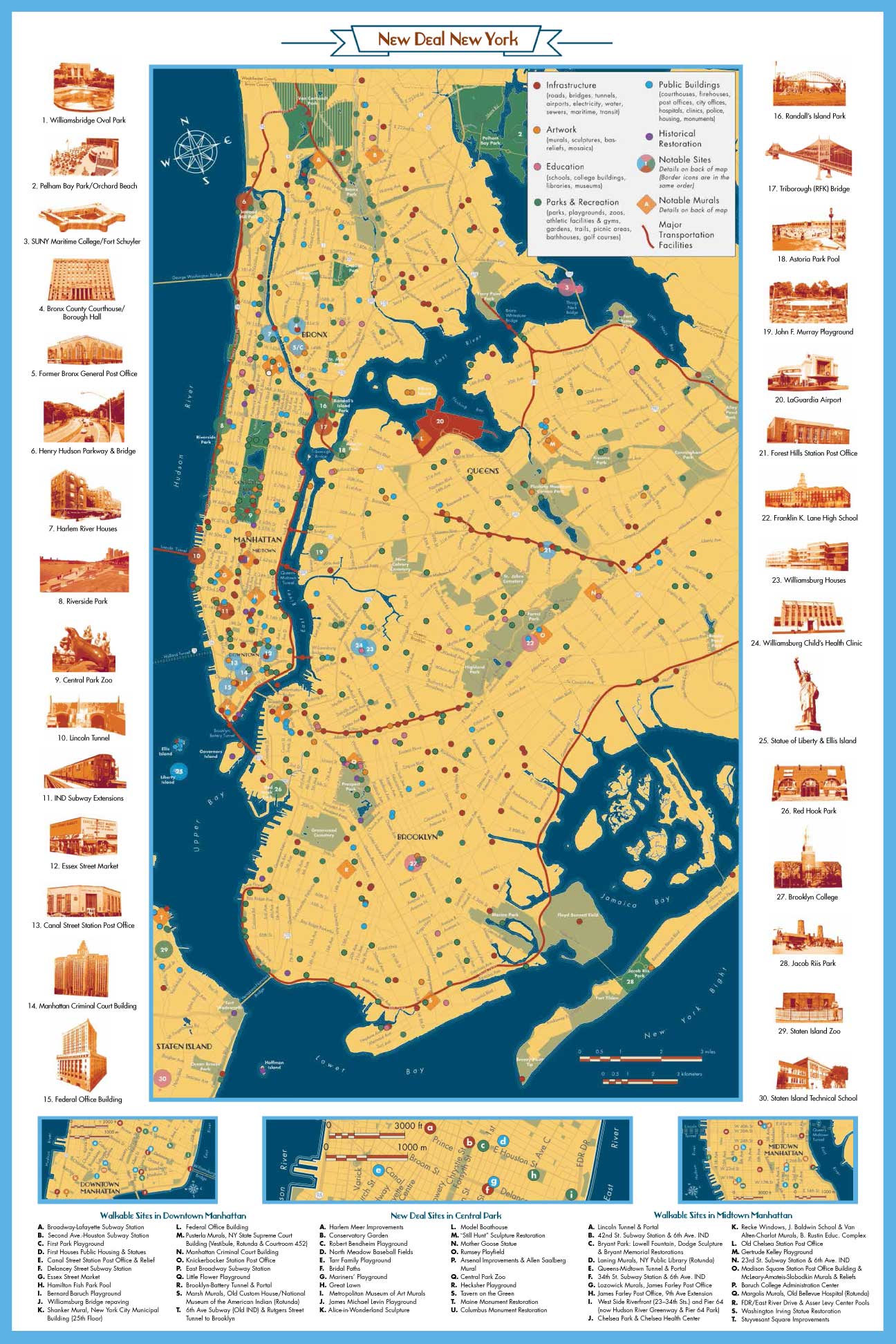
New York City Map and Guide

The Living New Deal has published a map and guide to New Deal sites in New York City.
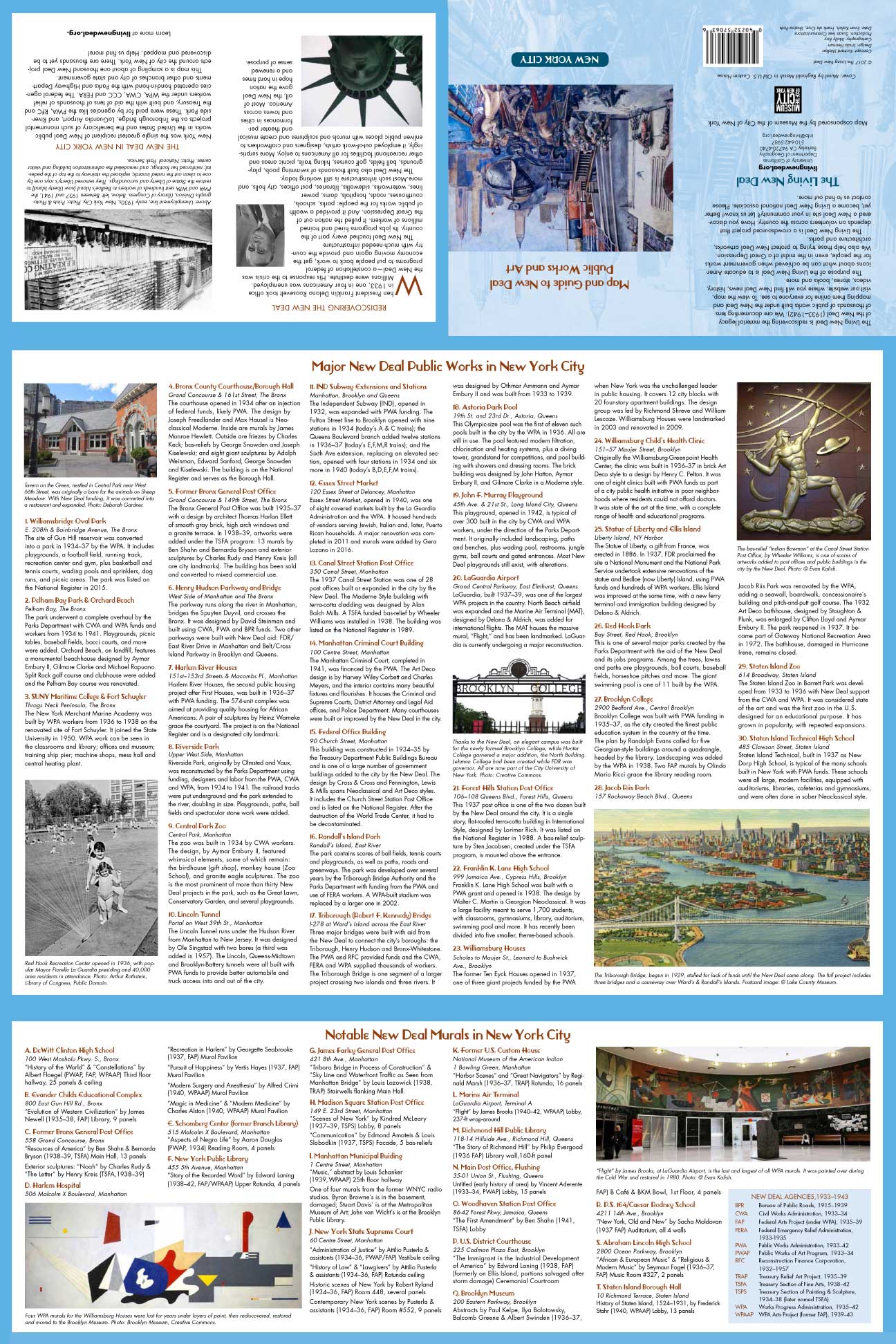
It covers almost one thousand works of all kinds— murals, parks, civic buildings, schools and more – and features 50 outstanding examples of public works and public art that transformed the nation’s leading city during the 1930s. The texts on the back of the map offer insights into the specifics of the top 50 sites, as well as introductions to the New Deal and the Living New Deal. The printed version folds neatly to pocket size for use by visitors, tour guides, preservationists, historians, public officials, teachers and students. The Living New Deal and a raft of co-sponsors are holding panels, conferences, and exhibits associated with our map and New Deal New York at large. Please check in with our Events Page for details.
We are selling the map for $5.