- City:
- Montpelier, VT
- Site Type:
- Dams, Infrastructure and Utilities, Flood and Erosion Control
- New Deal Agencies:
- Civilian Conservation Corps (CCC), Work Relief Programs
- Started:
- 1933
- Completed:
- 1935
- Quality of Information:
- Very Good
- Marked:
- Unknown
- Site Survival:
- Extant
Description
A flood in 1927 brought about plans to construct four flood control projects, made possible by the New Deal and the Civilian Conservation Corps (CCC).
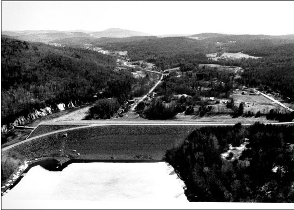
Wrightsville Dam is one of those. Construction began in August 1933 and was completed in October 1935. The dam is earthfill with stone slope protection. It is 1,525 feet long and 115 feet high.
The dam and reservoir are located on the North Branch of the Winooski River, about three miles north of Montpelier on Route 12. Its main purpose is to protect Montpelier.
According to the US Army Corps of Engineers: “Wrightsville Reservoir was one of four flood damage reduction projects constructed in Vermont by the Civilian Conservation Corps in the 1930s. Construction was overseen by the Corps’ North Atlantic Division. Because of accounting procedures, the construction costs of Wrightsville Reservoir were not calculated separately, but instead lumped together with the construction costs of East Barre Dam, Waterbury Reservoir, and the Winooski River Local Protection Project. The construction costs of these four projects totaled $13.7 million. Following completion, Wrightsville Reservoir was turned over to the State of Vermont for operation and maintenance.” (Army Corps)
In 1956-58, the dam was raised 20 feet and lengthened by 275 feet, and the spillway discharge channel was widened. (Army Corps)
Wrightsville Dam held in the great flood of July 2023 and received favorable newspaper coverage despite extensive flooding of Montpelier in that event (Vermont Digger)
A key aspect of the Wrightsville Dam and the other flood control projects not mentioned in these sources is that they were built by a CCC company made up entirely of African American World War I veterans.
Source notes
https://vermonthistory.org/documents/findaid/NorthBranchCem.pdf
https://www.nae.usace.army.mil/Missions/CivilWorks/FloodRiskManagement/Vermont/Wrightsville.aspx
Site originally submitted by Andrew Laverdiere on December 16, 2014.
Contribute to this Site
We welcome contributions of additional information on any New Deal site.
Submit More Information or Photographs for this New Deal Site
Please provide source material that supports the last ¶ of the above report. I spoke on numerous occasions with individuals involved in both the Wrightsville Dam and the Waterbury Dam CCC projects, in one case by a CCC member, in the other, by individuals who were youngsters when the dam was being built. (One of them asserted that he’d seen Kate Smith sing at the recreation field, where there had been boxing matches. That rec field site is where my house is built, and I recovered small whiskey bottles in the soil on what was the bank above the small meadow that was the recreation field.
I’ve been advised that there WAS a corps of “Buffalo Soldiers” encamped for four years in Colchester Vermont at Fort Ethan Allen, but they were veterans of the Spanish American War. This may be where there is possibility of confusion. The pronounced presence of black troops in such a white state is noted by the drop in the statewide black population back to 0.2% in 1920 from 0.5% in the 1910 census.
https://vermonthistory.org/client_media/files/Learn/Census%20Records/1930-Census.pdf
My query was driven by the fact that neither of the eye-witnesses to those projects with whom I’d spoken had mentioned anything about the presence of thousands of African Americans, and neither of them would have hesitated or neglected to mention that fact, especially the assertion above that the CCC camp laborers were “entirely” African American. A source for this assertion would be welcome.
Thank you