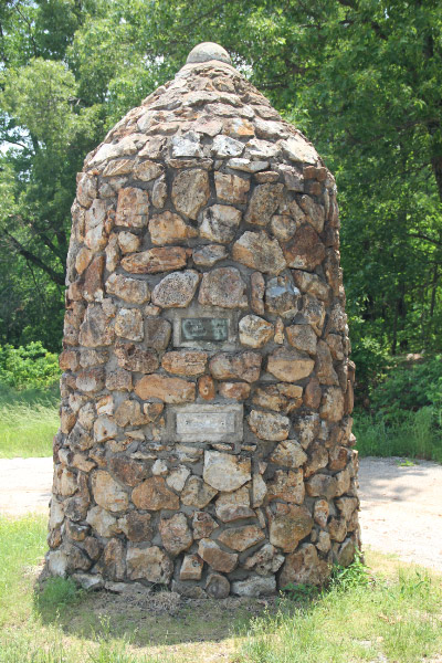
Tri-State Marker: OK-KS-MO – Quapaw OK

City:
Quapaw, KS, MO, OK

Site Type:
Civic Facilities, Monuments and Memorials

New Deal Agencies:
Work Relief Programs, National Youth Administration (NYA)

Description

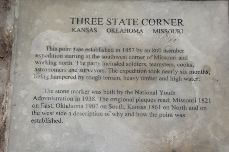
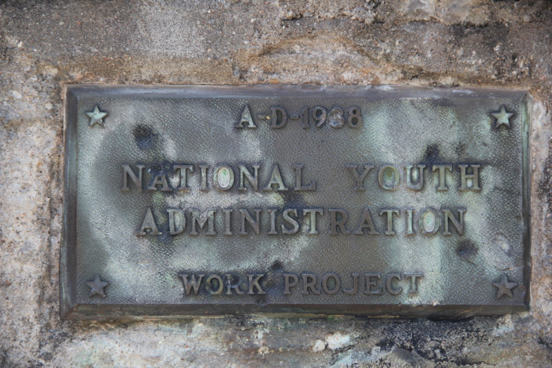
This small stone obelisk marks the point where Oklahoma, Kansas and Missouri meet. It was erected by the National Youth Administration in 1938.

It is located at the coordinates marked here, south of the Route 166 round-about at the entrance to an Oklahoma Casino, just south of the main entrance on a dirt road.

Source notes

Memorial plaque.

Site originally submitted by Charles Swaney on June 8, 2013.

Location Info


State Line Road
Quapaw, OK

Coordinates: 36.998633, -94.61809

Contribute to this Site

We welcome contributions of additional information on any New Deal site.

Submit More Information or Photographs for this New Deal Site
Join the Conversation

Please note:

  • We are not involved in the management of New Deal sites and have no information about visits, hours or rentals.
  • This page shows all the information we have for this site; if you have new information or photos to share, click the button above.

Your email address will not be published, shared, or sold.

This site uses Akismet to reduce spam. Learn how your comment data is processed.

Contribute to this Site

We welcome contributions of additional information on any New Deal project site.

Submit More Information or Photographs for this New Deal Site
Join the Conversation

Please note:

  • We are not involved in the management of New Deal sites and have no information about visits, hours or rentals.
  • This page shows all the information we have for this site; if you have new information or photos to share, click the button above.

Your email address will not be published, shared, or sold.

This site uses Akismet to reduce spam. Learn how your comment data is processed.