- City:
- San Antonio, TX
- Site Type:
- Civic Facilities, Parks and Recreation, Archaeology and History, Monuments and Memorials, Historical Restoration
- New Deal Agencies:
- Federal Emergency Relief Administration (FERA), Work Relief Programs, Civil Works Administration (CWA)
- Started:
- 1934
- Completed:
- 1938
- Designers:
- City Planner, H.E. Kincaid
Description
Multiple New Deal agencies were involved with improving the grounds at the Alamo.
A timeline mural board on the west side of the Alamo Museum indicates that “depression-era public works projects” built the walls that now encompass the grounds of the Alamo in San Antonio, Texas. The Alamo is regarded as the “Shrine of Texas Liberty” due to its location of the famous battle within its perimeter during the Texas Revolution; however, it was originally the site of Mission San Antonio Valero which was moved here in 1724 after several previous locations in the area were not suitable.
The New York Times reported: “Unsightly buildings which have stood for years adjoining the Alamo to the south are being demolished, and the property on which they stood will be converted into the Alamo State Park. The work of razing the buildings and beautifying the park is being paid for by CWA funds.”
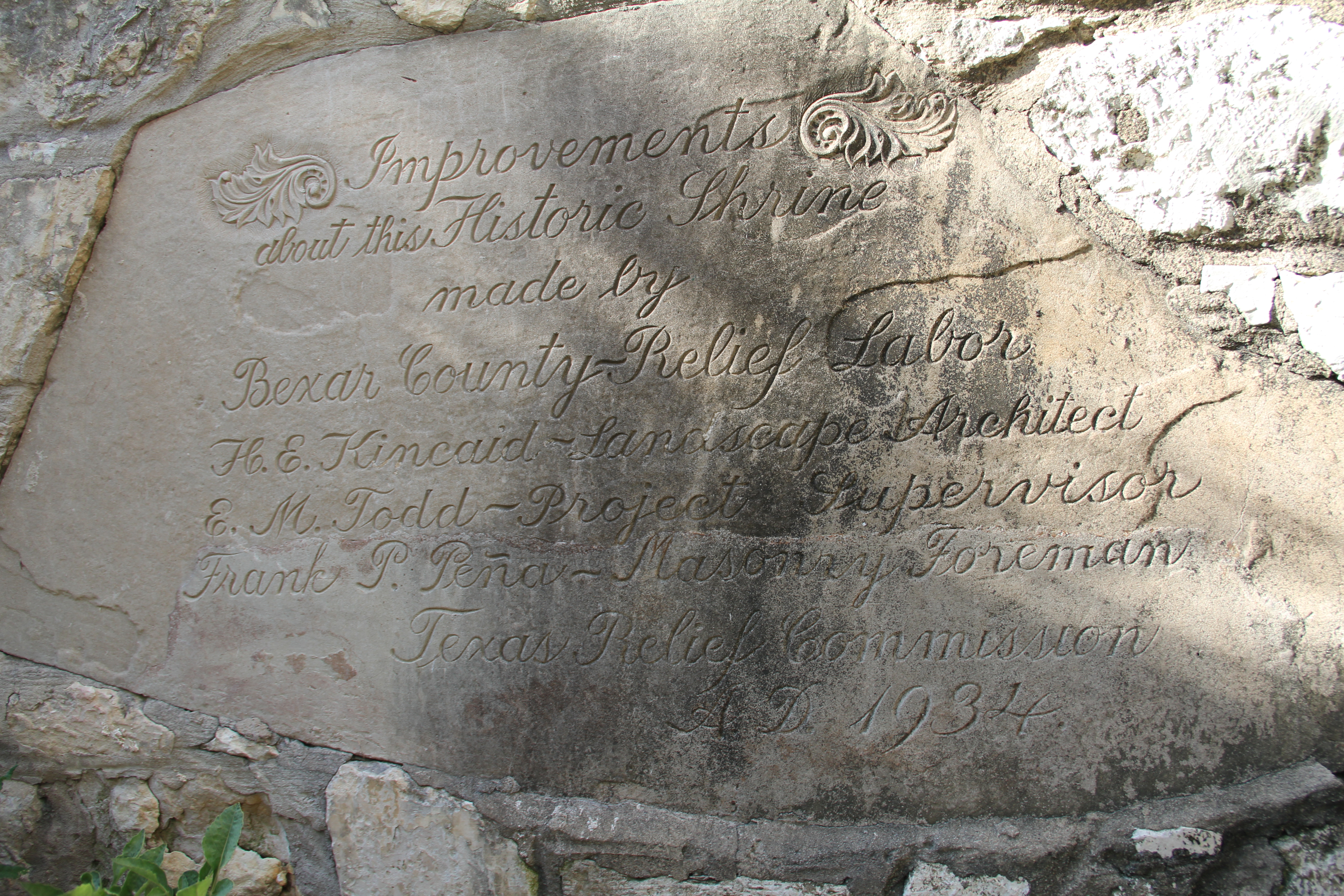
The caption from a photograph in the September 1934 San Antonio Light reveals that FERA built the Roman-style stone arches that now run south from the façade of the Alamo chapel and built the garden area behind the chapel. Further research indicates that WPA and NYA workers built a wall around the perimeter of the grounds, the museum building, and demolished several old buildings on the property including the old central fire station where the DRT Meeting Hall would be built (this was previously submitted). Some sources suggest that restoration of the acequia that runs through the property may have been funded with federal funds.
Source notes
Roberts, Randy; Olson, James S. (2001), A Line in the Sand: The Alamo in Blood and Memory. New York: Touchstone.
San Antonio Light, September 1934, Retrieved from https://digital.utsa.edu/cdm/singleitem/collection/p9020coll2/id/6252/rec/1
Edmondson, J.C., Alamo Story: From Early History to Current Conflicts
Marker now embedded in wall of Alamo Hall (DRT Meeting Hall) facing Crocket St indicates work done through FERA.
The New York Times: "TEXAS IS BEAUTIFYING ALAMO STATE PARK," March 25, 1934 (pg. 6)
Contribute to this Site
We welcome contributions of additional information on any New Deal site.
Submit More Information or Photographs for this New Deal Site


Join the Conversation