- City:
- Buxton, ME
- Site Type:
- Infrastructure and Utilities, Roads, Bridges, and Tunnels
- New Deal Agencies:
- Public Works Funding, Bureau of Public Roads (BPR)
- Started:
- 1936
- Completed:
- 1937
- Contractors:
- Harris Structural Steel Company of New York, New York
- Quality of Information:
- Very Good
- Marked:
- No
Description
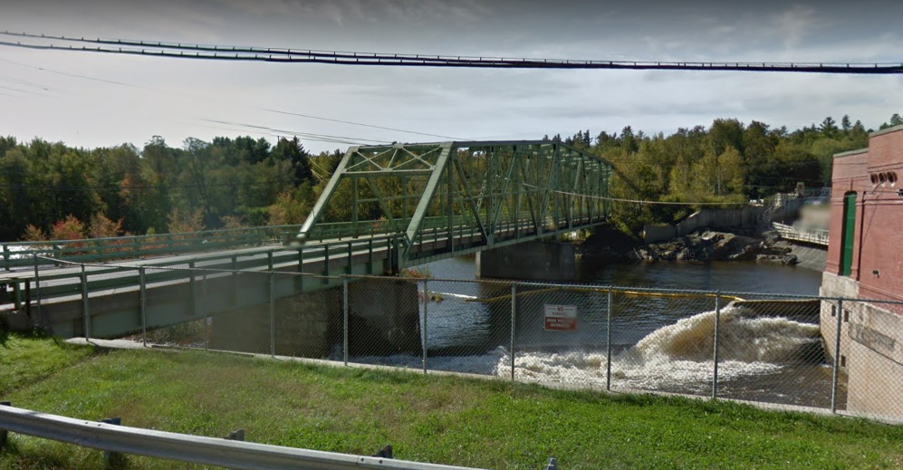
The West Buxton bridge is a 607 foot Metal Continuous Rivet-Connected Polygonal Warren Through Truss with fixed and Approach Spans: Metal Stringer (Multi-Beam) that carries the West Buxton Road (Moderation Street) over the Saco River. This was one of 26 bridges that were badly damaged or destroyed by a 500 year flood in March 1936. A 1936 report by the state highway commission notes that the reconstruction of these bridges were U.S. Works Program Flood Relief projects and were handled under the jurisdiction of the Bureau of Public Roads, U.S. Department of Agriculture. This bridge is one of only three known examples of continuous trusses in Maine that display the appearance of a very long simple span truss supported by piers. In this design, the truss has no “cantilever truss shape.” Continuous trusses of this design are also extremely rare nationwide.
“March 1936 flood was one of the most destructive, resulting in the loss or damage of an estimated 150 bridges in Maine, believed to be the hardest hit of the New England states due to the force of the flood and crest of the ice pack on the Saco, Androscoggin, Kennebec, and Penobscot rivers. Assistance to the affected states in repairing and replacing bridges was given by the PWA through the U.S. Works Program Flood Replacement Project. The project totaled about $2.5 million of which about half was distributed to Maine.”
Source notes
Historic Bridges of Maine: 350 Years of Bridge and Roadway Design Edited by David E. Gardner & Lisa Churchill-Dickson
https://historicbridges.org/bridges/browser/?bridgebrowser=maine/westbuxton/
Site originally submitted by Andrew Laverdiere on July 11, 2021.
Contribute to this Site
We welcome contributions of additional information on any New Deal site.
Submit More Information or Photographs for this New Deal Site
Join the Conversation