- City:
- Graford, TX
- Site Type:
- Roads, Bridges, and Tunnels, Infrastructure and Utilities
- New Deal Agencies:
- Work Relief Programs, Works Progress Administration (WPA)
- Started:
- 1940
- Completed:
- 1942
- Quality of Information:
- Very Good
- Marked:
- No
- Site Survival:
- Extant
Description
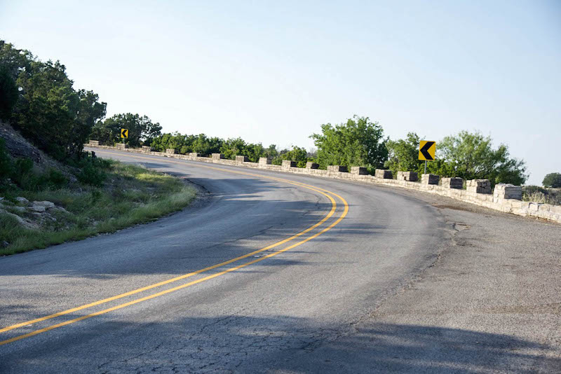
The Work Projects Administration constructed and improved 27.75 miles of SH 16, between Brackeen Drive and State Highway 254, and State Highway 254 in Palo Pinto County below Possum Kingdom Dam between 1940-1942. This section, the corridor from Brackeen Drive to State Highway 254, included the masonry bridge across the Brazos River, a masonry guard wall around Kimberlin Mountain, and 21 masonry culverts. Of the 21, 16 are still in original condition. The guard wall is approximately 1,800 feet long with limestone block crenellations spaced along the wall. Of the 129 original crenellations, 88 remain unaltered or undamaged and in original condition. The wall is two feet tall, and the crenellations are spaced every four feet. During the construction of the Morris Sheppard Dam (also called Possum Kingdom Dam) built 1938-1941, the WPA constructed haul roads to transport supplies and the 27.75 mile road to provide access to the East side of the lake. The proposal to construct the guard wall was due to the hazardous winding road around Kimberlin Mountain, and the project was completed November 1942. Limestone was quarried from the top of Kimberlin Mountain for the guard wall, culverts, and the masonry arch bridge across the Brazos River below the dam.
Source notes
Russo, M., Reynolds, A., & Lapham, R. (2013). Nomination form National Register of Historic Places, State Highway 16, Brazos River Bridge Segment, Graford vicinity, Palo Pinto County, Texas.
State Highway 16 Corridor. Texas Historical Commission. Retrieved from (https://www.thc.texas.gov/preserve/projects-and-programs/historic-texas-highways/researching-roads-roadside-architecture/20t-4), July 4, 2018.
Site originally submitted by Susan Allen on July 8, 2018.
Contribute to this Site
We welcome contributions of additional information on any New Deal site.
Submit More Information or Photographs for this New Deal Site

Join the Conversation