- City:
- Silverton, OR
- Site Type:
- Parks and Recreation, Forestry and Agriculture, Lodges, Ranger Stations and Visitor Centers, Paths and Trails, Picnic and Other Facilities, Park Roads and Bridges, Landscaping and Tree Planting, CCC Camps
- New Deal Agencies:
- Civilian Conservation Corps (CCC), Housing Programs, Work Relief Programs, Resettlement Administration (RA), Works Progress Administration (WPA)
- Started:
- 1935
- Completed:
- 1942
- Quality of Information:
- Very Good
- Marked:
- Yes
- Site Survival:
- Extant
Description
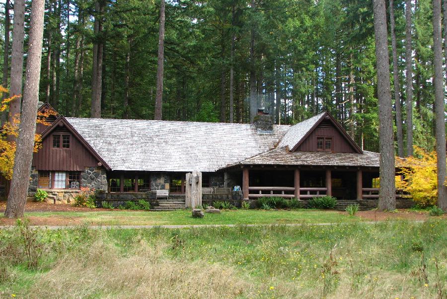
Although the State’s initial acquisition of land for the park occurred in 1931, the early development of Silver Falls State Park can be credited to several of the New Deal programs. A significant portion of the land for the park was purchased by the federal Resettlement Administration (RA) c 1935, and developed for recreational use through the work of the Civilian Conservation Corps (CCC) and Works Progress Administration (WPA) between 1935 and 1942.
As shown on the map below, a portion of the land that became Silver Falls State Park was once Silver Falls City. Surrounding this old logging town, the forest had been repeatedly cut over, leaving large tracts of land bare except for stumps. In other instances, wild fires had left snags behind. Some of the area supported farming but was marginal land. The New Deal Resettlement Administration “retired” acres of such land for the state park’s use or for youth camps. Initially, as shown on the map, the State park land and the youth camps (designed as a Recreation Demonstration Area) were separate entities. The public park, meant for the general public’s use, lay to the northwest. The other land, laid out specifically for the benefit of young campers from the nearby city of Salem, was to the southeast. CCC and WPA enrollees did the hard work of land restoration, and trail and campground development.
CCC enrollees built several rustic-style park structures in the South Falls area as well as trails leading to the ten falls along the Silver Creek Canyon area. The trail work included bridges, stairways, and rock walls. The CCC camp remained at the site to the north of the park until 1942.The former CCC Camp occupied the area now known as the park’s North Falls Group Camp.
WPA relief workers constructed the main concession building, the South Falls Lodge, and Federal Arts Project WPA workers in Portland made a number of myrtle wood benches and tables for the building, many of which remain in use today. The exact dates of the WPA work are uncertain. The construction of the youth camps is also credited to WPA workers.
In 1947,the Federal Government transferred the acquired lands along with the state’s original park property to the State of Oregon. At the time, the park covered around 6,300 acres. Successive purchases have increased its size to approximately 9,000 acres making it the largest of Oregon’s parks.
There are two historic districts within the park, including the South Falls Historic District and the Silver Creek Youth Camp Historic District.
Source notes
https://www.oregonencyclopedia.org/entry/view/silver_falls_state_park/
https://www.friendsofsilverfalls.net/files/History.html
Site originally submitted by Philip Arola on May 6, 2012.
Additional contributions by Richard A Walker, Judith Kenny.
Contribute to this Site
We welcome contributions of additional information on any New Deal site.
Submit More Information or Photographs for this New Deal Site


Join the Conversation