- City:
- Grand Junction, CO
- Site Type:
- Parks and Recreation, Lodges, Ranger Stations and Visitor Centers
- New Deal Agencies:
- Civilian Conservation Corps (CCC), Work Relief Programs
Description
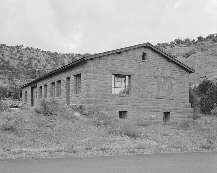
“Significant for its association with the CCC and WPA, the district includes four good examples of National Park Service Rustic style architecture. The structures were constructed of locally quarried sandstone by the CCC with Emergency Conservation Works funding. The 1937 Roads and Trails Shop, 1938 Oil House, and 1941 Open Storage Building functioned as garages, warehouses, storage facilities, and maintenance buildings for the park. Completed in 1942, the Building and Utilities Shop housed the primary administrative offices for Colorado National Monument until 1963, when a Visitor Center was completed.” (www.historycolorado.org)
The utility area is located at the intersection of Rim Rock Drive and the Saddle horn Loop, named after a distinctive nearby rock formation. It is separated from the caretaker’s house by a low hill. (wikipedia)
Source notes
The New Deal in Colorado: 1933-1942
https://en.wikipedia.org/wiki/Saddlehorn_Utility_Area_Historic_District
At this Location:
Contribute to this Site
We welcome contributions of additional information on any New Deal site.
Submit More Information or Photographs for this New Deal Site
Join the Conversation