- City:
- Mt Nebo, UT
- Site Type:
- Parks and Recreation, Paths and Trails
- New Deal Agencies:
- Civilian Conservation Corps (CCC), Work Relief Programs
- Started:
- 1934
- Completed:
- 1938
- Quality of Information:
- Good
- Marked:
- No
- Site Survival:
- Extant
Description
The Civilian Conservation Corps (CCC) made extensive recreational improvements on Mt. Nebo, the highest and southern-most peak of the Wasatch Mountains. The CCC teams worked out of three camps: F-9 at the south end of the Mt. Nebo Loop, F-3 at Hubble Canyon and F-40 near Provo, from 1933 to 1938 – and possibly to 1941 when the last camp closed.
After building the Mt Nebo Loop Road (Scenic Byway), the CCC enrollees created several campgrounds, picnic areas and many trails. Not all this work can be identified precisely, but some can be verified from reliable sources.
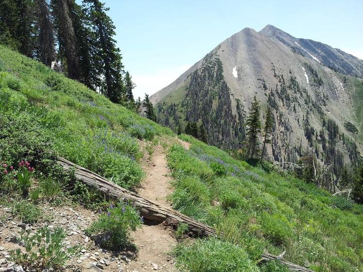
The trails laid out by the CCC, with trailheads along the Mt Nebo Loop Road, most likely include (from north to south) Red Lake, Grotto Falls, Shram Falls, Double Falls, Loafer Mountain, Rock Springs, Jones Ranch, Blackhawk, Twin Knolls, Monument, North Nebo Peak, Bear Canyon and Salt Creek. CCC trails were normally of excellent quality.
Curiously, we cannot find a good trail map online to use here to show the wealth of trails in the Mt Nebo area. More Mt Nebo trail photos by local hikers would be greatly appreciated!
Source notes
Kenneth Baldridge, The Civilian Conservation Corps in Utah. Salt Lake City: University of Utah Press, 2019. pp. 74, 122.
"A Century of Stewardship: Civilian Conservation Corps on the Uinta National Forest" at https://www.fs.usda.gov/detail/uwcnf/learning/history-culture/?cid=stelprdb5052898
Utah SHPO CCC Database, 3-29-2021
Site originally submitted by Richard A Walker on July 16, 2021.
Additional contributions by Joan Greer.
At this Location:
Contribute to this Site
We welcome contributions of additional information on any New Deal site.
Submit More Information or Photographs for this New Deal Site


Join the Conversation