- City:
- New Orleans, LA
- Site Type:
- Parks and Recreation
- New Deal Agencies:
- Work Relief Programs, Works Progress Administration (WPA)
Description
The Wikipedia entry on City Park provides a good summary of park history, including the role of the WPA in making improvements to the park:
“City Park, a 1,300 acre (5.3 km²) public park in New Orleans, Louisiana, is the 6th-largest and 7th-most-visited urban public park in the United States. City Park is approximately 50% larger than Central Park in New York City, the municipal park recognized by Americans nationwide as the archetypal urban greenspace…
City Park was established in the mid-19th century on land fronting Metairie Road (now City Park Avenue), along the remains of Bayou Metairie, a former distributary of the Mississippi River…
In the first two decades of the 20th century, numerous improvements were undertaken by the City Park Improvement Association. Notable park landmarks like the Casino, the Peristyle, Popp Bandstand, Lelong Drive and the Issac Delgado Museum of Art were constructed. City Park’s governing board also accomplished a number of large land acquisitions, such that the park assumed its current boundaries.
A master plan, by Bennett, Parsons & Frost of Chicago, was commissioned to guide the development of the greatly enlarged park; this plan was largely implemented in the 1930s by federal relief agencies, such as the Works Progress Administration.
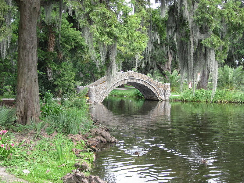
Substantial improvements were made to the park’s newly-acquired land by the Works Progress Administration, including the installation of many sculptures by WPA artist Enrique Alferez, construction of buildings, bridges, roads, and much of the electrical and plumbing infrastructure that were still serving the park when Hurricane Katrina struck in 2005.
A formal rose garden was developed, the genesis of today’s New Orleans Botanical Garden. The WPA also planted Couterie Forest and constructed Popp Fountain, City Park (Tad Gormley) Stadium, a second 18-hole golf course – home for many years to the New Orleans Open golf tournament – and a golf clubhouse, which was later partially demolished to accommodate I-610.”
Source notes
https://en.wikipedia.org/wiki/City_Park_%28New_Orleans%29
Contribute to this Site
We welcome contributions of additional information on any New Deal site.
Submit More Information or Photographs for this New Deal Site
Join the Conversation