▼
![]()
Every dot is a New Deal site
To learn more, click on a dot
Help
This map shows New Deal public works and artworks documented by the Living New Deal. Every site is marked by a dot. Click on any dot and the panel shows what is there. For more on that site, click on Full Info. To close the panel, click on "x".
To find New Deal sites near you, tap the geolocate button at the top right ![]() and the map will zoom in to your location (if you give permission). Zoom in and
out with +/- and go back to the whole country by clicking on reset
and the map will zoom in to your location (if you give permission). Zoom in and
out with +/- and go back to the whole country by clicking on reset ![]() .
.
As you zoom in, dots become icons showing the function (category) of different sites.
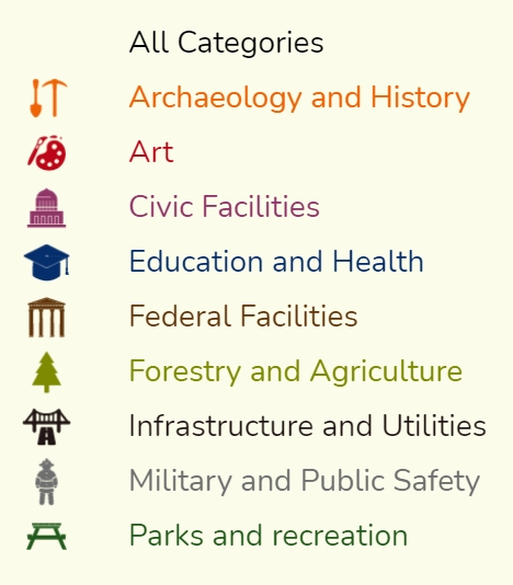
You can search the map by place name. You can also filter specific types of sites by selecting a category or agency. Category and agency lists accordion out to finer levels.(To start over, go back to All Categories/All Agencies)
Tens of thousands of New Deal public works and artworks are still to be discovered in every county, state, and territory of the USA. Many are still in use and most are not marked as New Deal. If you want to contribute information or photos for sites you find, submit documentation on our website or download the Living New Deal app to submit facts and photos by iPhone. We are happy to share data for your research, please inquire at [email protected]
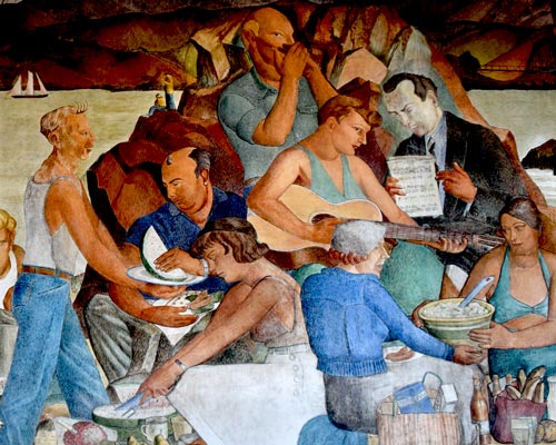
This map shows New Deal public works and artworks documented by the Living New Deal. New Deal sites are marked by dots, which contain icons as you zoom closer. Icons show the function (category) of sites (art, parks, infrastructure, etc).
Click on any dot and the sliding panel will come up to show what is there. For more, click on
Full Info button. ![]() To search another site, click on the red "reset" button.
To search another site, click on the red "reset" button. ![]()
To see New Deal sites near you, tap the geolocate button at the top right. ![]() The map will zoom in to your location (if you give permission).
The map will zoom in to your location (if you give permission).
You can zoom in
and out or go back to the whole country by tapping the white reset button in the top right corner. ![]()
You can search the map by typing in a place name. ![]() Be forewarned that place names don't always correspond with New Deal site names.
Be forewarned that place names don't always correspond with New Deal site names.
You can filter specific types of sites by selecting a category or agency. Category and agency lists accordion out to finer levels. (To start over, go back to All Categories/All Agencies)
Tens of thousands of New Deal public works and artworks are still to be discovered in every county, state, and territory of the USA. Many are still in use and most are not marked as New Deal. If you want to contribute information or photos for sites you find, submit documentation on our website or download the Living New Deal app to submit facts and photos by iPhone. We are happy to share data for your research, please inquire at [email protected]